
Fri Jan 09 13:00:00 UTC 2026: ### Central Wisconsin Braces for Fog, Mild Temperatures Before Potential Weekend Snow
The Story:
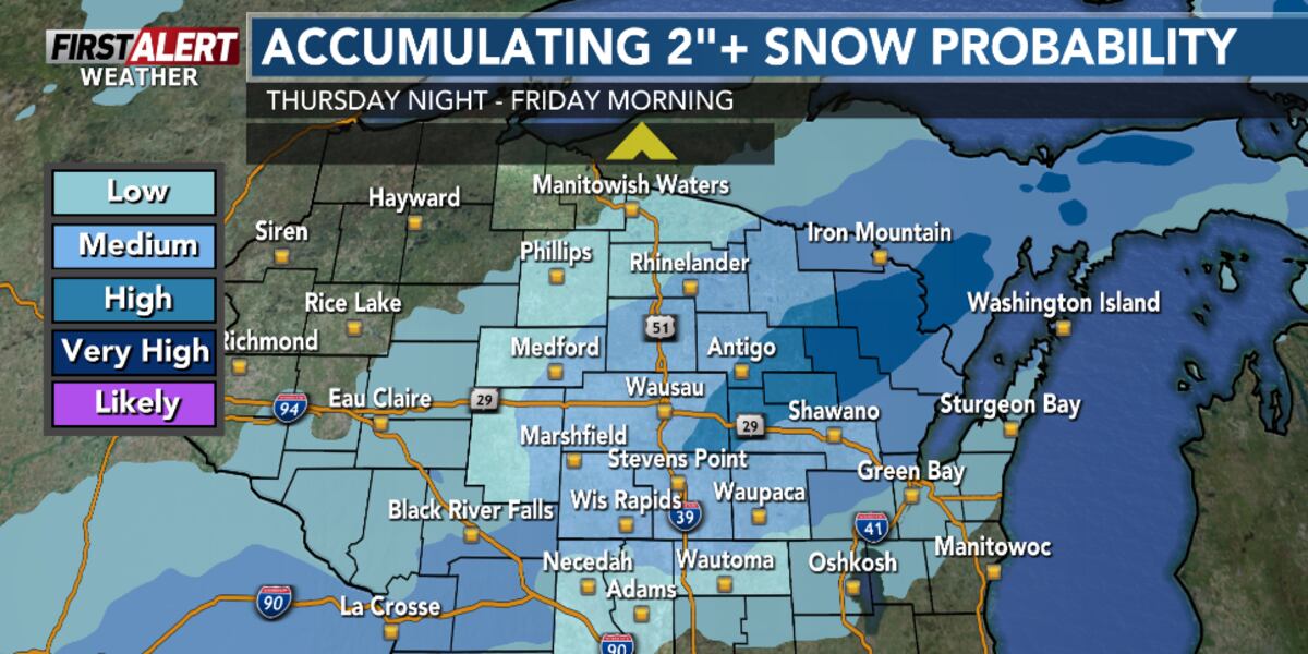
Central Wisconsin residents should prepare for a period of mixed weather conditions. The immediate forecast predicts an end to rain and snow, followed by patchy, dense fog, particularly during early Wednesday, January 14, 2026, morning. Milder temperatures are expected Wednesday and Thursday, with highs potentially reaching the low 40s in some southern areas. However, the mild temperatures and melting snow could exacerbate fog formation over the next few days. Looking ahead, the forecast indicates a chance of snow on Friday and Saturday, with the potential for moderate accumulations that could trigger a “First Alert Weather Day” declaration.
Key Points:
- Rain and snow ending tonight.
- Patchy, dense fog expected early Wednesday, January 14, 2026 morning.
- Mild temperatures forecast for Wednesday and Thursday, with highs in the mid to upper-30s, possibly reaching 40°F further south on Thursday.
- Dense fog most likely Wednesday night into Thursday morning.
- Potential for snow on Friday and Saturday, with possible moderate accumulations.
- Temperatures to remain above average throughout the next week.
Key Takeaways:
- Travel conditions in central Wisconsin could be hazardous due to dense fog, particularly during the early morning hours of Wednesday, January 14, 2026, and Thursday, January 15, 2026.
- The combination of melting snow and light winds is contributing to the increased likelihood of fog formation.
- Residents should monitor weather forecasts closely for updates on the potential snow event expected on Friday, January 17, 2026 and Saturday, January 18, 2026, which could significantly impact travel and daily activities.
- Despite the potential for snow, temperatures are expected to remain above average for the next week, indicating a continued mild trend overall.
