
Tue Apr 01 04:38:36 UTC 2025: ## ISRO Satellite Images Reveal Extent of Myanmar Earthquake Damage
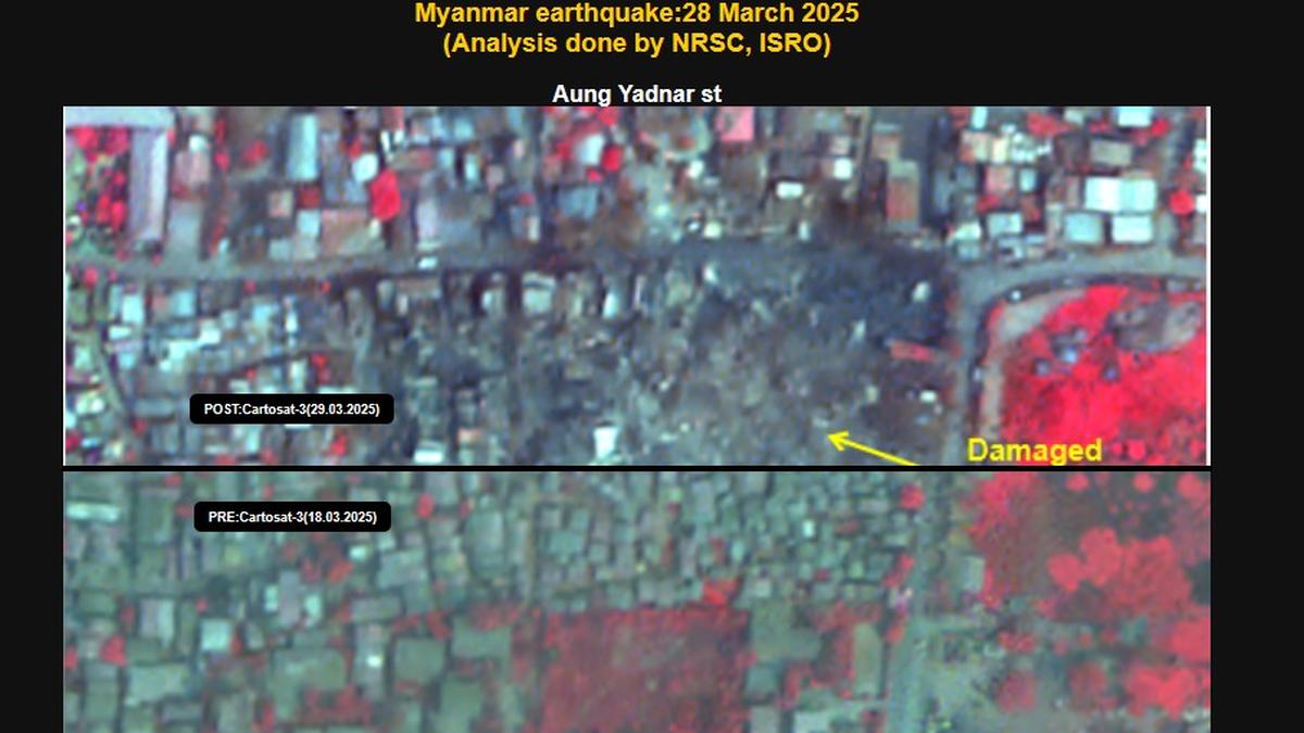
**Bengaluru, April 1, 2025** – The Indian Space Research Organisation (ISRO) has released satellite imagery showing the devastating impact of the March 28th earthquake in Myanmar. Images captured by the CARTOSAT-3 satellite, a high-resolution earth imaging and mapping satellite, reveal significant damage to infrastructure in Mandalay and Sagaing cities.
The 7.7 magnitude earthquake, with a subsequent 6.4 magnitude aftershock, struck near the Sagaing-Mandalay border. ISRO’s pre- and post-event imagery analysis shows extensive damage to numerous landmarks in Mandalay, including the Sky Villa, Phayani Pagoda, Mahamuni Pagoda, Ananda Pagoda, and the University of Mandalay. In Sagaing, the Ma Shi Khana Pagoda and several monasteries and buildings suffered damage.
The imagery also confirms the complete collapse of the historic Ava (InnWa) Bridge near Inn Wa City. Further analysis revealed ground ruptures, cracks, and evidence of liquefaction in the Irrawaddy River floodplains.
The earthquake’s impact extended beyond Mandalay and Sagaing. Severe damage was reported in Naypyidaw, and tremors were felt as far as Chiang Mai and northern Thailand, where some damage was also reported. ISRO’s use of CARTOSAT-3 highlights the valuable role of space technology in disaster assessment and response.
