
Thu Apr 02 19:20:00 UTC 2026: ### Headline: Tornado Watch Issued for Areas Near Waterloo; Severe Storms Expected
The Story:
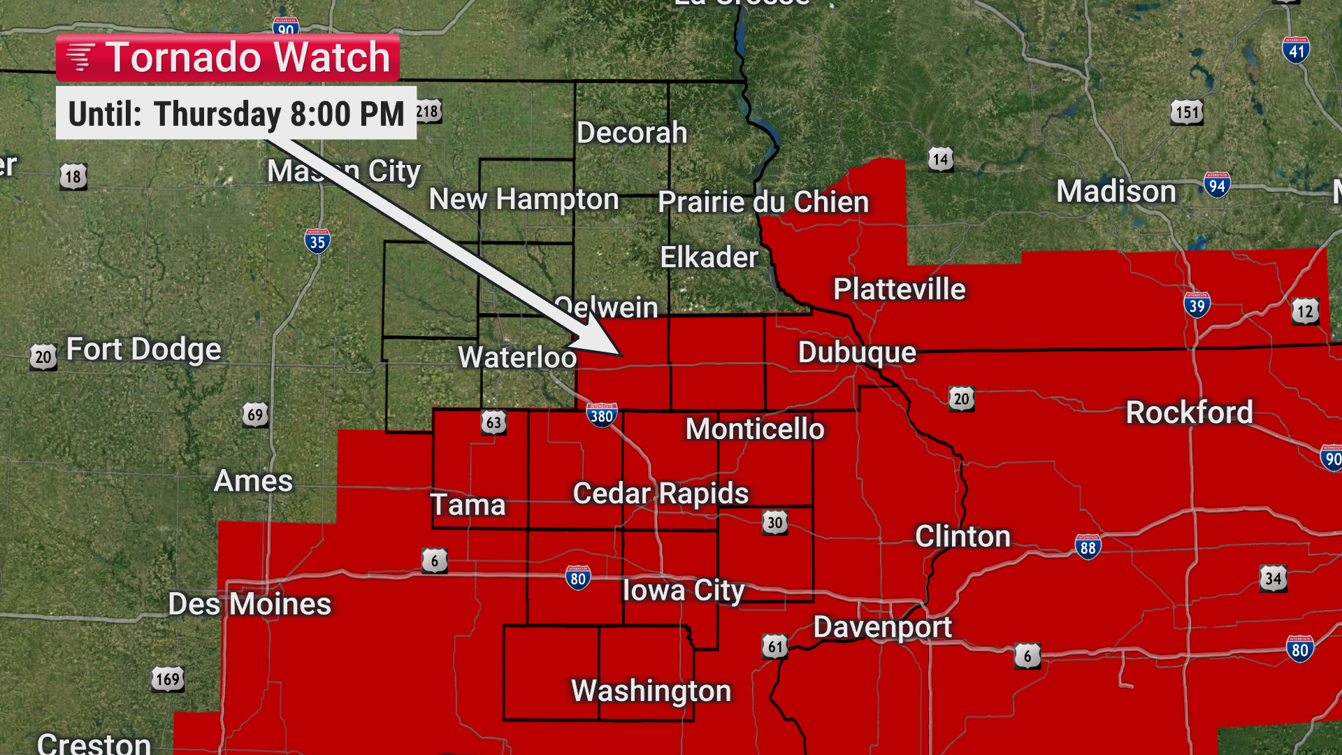
A tornado watch has been issued until 8 PM for areas east and south of Waterloo, indicating a high risk of severe weather. The forecast predicts strong to severe storms capable of producing large hail, damaging winds, and tornadoes. Residents are urged to remain vigilant and monitor weather conditions due to the fast-moving nature of the storms, which will limit reaction time. Furthermore, a Level 3 out of 5 risk for severe storms is forecasted for Friday, with the potential for large hail, damaging winds, and tornadoes from 3 PM to midnight.
Key Points:
* A tornado watch is in effect until 8 PM for areas east and south of Waterloo.
* Strong to severe storms are expected with the possibility of large hail, damaging winds, and tornadoes.
* Storms are expected to move quickly, limiting reaction time.
* A Level 3 out of 5 risk for severe storms is forecasted for Friday from 3 PM to midnight.
* Strong to severe storms are expected to continue until about 10 PM to midnight Friday night.
Key Takeaways:
* The immediate risk of severe weather necessitates heightened awareness and preparedness among residents near Waterloo.
* The prolonged period of potential severe weather, spanning Thursday evening and all day Friday, requires sustained vigilance.
* The fast-moving nature of the storms emphasizes the need for timely weather updates and quick decision-making.
