
Thu Apr 02 11:30:00 UTC 2026: ### Nebraska Braces for Cooler, Wetter Weather Pattern After Record Heat
The Story:
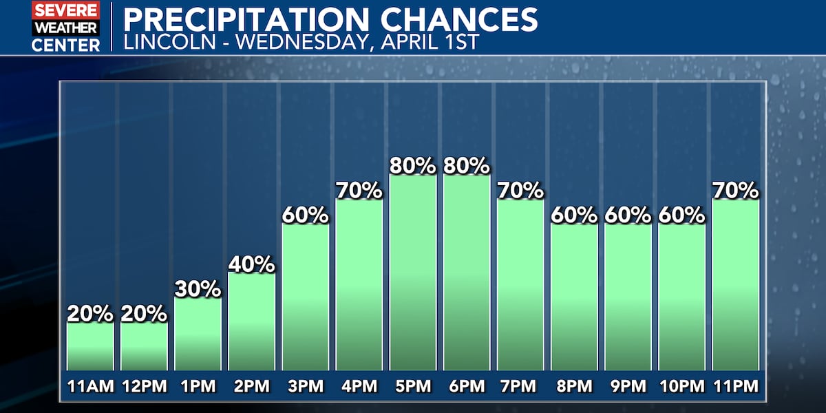
Following record-breaking heat on Monday, April 1, 2026, Nebraska is set to experience a significant weather shift. A cold front moving across the region on Tuesday will usher in cooler air and strong winds. By Wednesday, the focus will turn to much-needed moisture as widespread rain showers develop across the state. The weather pattern will persist through the end of the week, with a second system bringing additional rain chances on Friday. While the anticipated precipitation won’t eliminate the ongoing drought, it is expected to provide beneficial moisture for vegetation and temporarily reduce fire danger.
Key Points:
- A cold front will move across Nebraska on Tuesday, April 1, 2026, bringing cooler air and strong winds.
- Widespread rain showers are expected across Nebraska starting Wednesday, April 2, 2026.
- A wintry mix of sleet and snow is possible in northeast Nebraska, but significant accumulations are not expected due to warm surface temperatures.
- A Marginal (Level 1 of 5) risk of strong to severe storms exists for far southeast Nebraska Wednesday night into Thursday morning.
- A second weather system will bring rain chances back to the region on Friday, April 4, 2026, potentially turning to snow in northern Nebraska.
- Overall precipitation amounts are expected to range from 0.5 to 1.5 inches Wednesday through Saturday.
Key Takeaways:
- Nebraska is experiencing a significant shift from record heat to a cooler, wetter pattern.
- The anticipated rainfall is a welcome relief for drought-stricken areas, even if it doesn’t completely eliminate the drought.
- There is a risk of severe weather in far southeast Nebraska.
- The weather pattern is expected to be active throughout the week, with multiple systems bringing precipitation.
- The shift to cooler temperatures could impact agricultural activities and require adjustments for farmers.
