
Thu Apr 02 06:20:00 UTC 2026: ### Bay Area Braces for Coolest Day Since February Amidst Return of Rain
The Story:
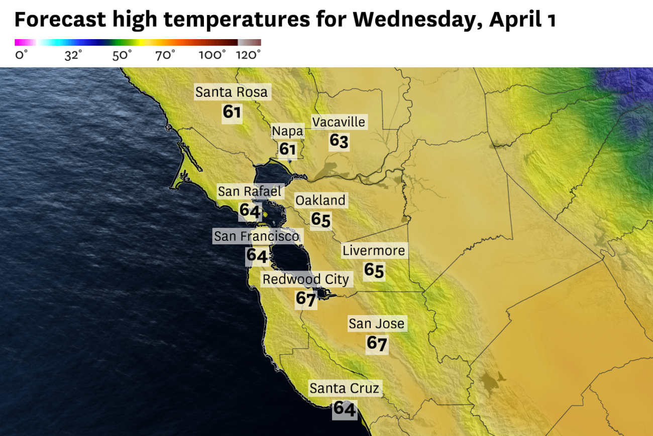
The San Francisco Bay Area is preparing for a significant shift in weather patterns, with Wednesday forecast to be the coolest day since February. After a brief respite from dry conditions with scattered showers on Tuesday, a more widespread rain event is expected, accompanied by gusty winds. The National Weather Service warns of slick roadways due to accumulated oil from the previous dry spell. Temperatures will range from the upper 50s to mid-60s, below normal in the North Bay and near normal elsewhere.
The rain is expected to intensify throughout the day, reaching San Francisco and Oakland during the evening commute and San Jose around 10 p.m. A warming trend is anticipated starting Friday, with temperatures climbing back into the 70s and 80s by the weekend.
Key Points:
- Coolest Day: Wednesday will be the coolest day in the Bay Area since February.
- Widespread Rain: A more organized cold front will bring widespread rain.
- Gusty Winds: Southwest gusts of 20-30 mph are predicted ahead of the front, with northwest gusts up to 25 mph behind it.
- Slick Roadways: The National Weather Service warns of slick roadways due to oil accumulation.
- Temperature Range: Highs will be in the upper 50s to mid-60s, with lows in the upper 30s to mid-40s.
- Warming Trend: Dry weather will return by midmorning Thursday, with a warming trend anticipated Friday through the weekend.
Key Takeaways:
- The Bay Area is experiencing a return to cooler, wetter conditions after a dry spell.
- Commuters should be prepared for slick roadways and potential delays due to rain and wind.
- The cool weather is expected to be short-lived, with warmer temperatures returning by the end of the week.
- The rain event is associated with a more organized cold front than previous showers.
