
Fri Jan 16 12:40:00 UTC 2026: ### Iowa Braces for Dangerous Winter Weather Conditions
The Story:
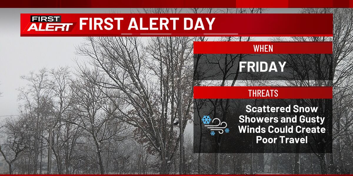
Eastern Iowa is under a First Alert Day due to expected snow showers and gusty winds that could lead to reduced visibility and slick roads. The National Weather Service has issued a Winter Weather Advisory from 6:00 a.m. to 9:00 p.m. today, warning of potential snow squalls and difficult travel conditions. Residents are advised to exercise extreme caution, reduce speed, and avoid travel if a Snow Squall Warning is issued. The weather pattern is expected to persist through the weekend, with another chance of snow on Sunday and frigid temperatures forecast for Martin Luther King, Jr. Day on Monday.
Key Points:
- First Alert Day declared for eastern Iowa due to snow showers and gusty winds.
- Winter Weather Advisory in effect from 6:00 a.m. to 9:00 p.m. today.
- Potential for snow squalls leading to near-zero visibility and snow-covered roads.
- Snow accumulation between a trace and 2 inches expected.
- Temperatures to fall throughout the day, reaching the 10s and 20s by nightfall, with single-digit wind chills.
- Below-zero wind chills expected Saturday morning.
- Another chance of snow on Sunday afternoon and evening.
- Very cold weather forecast for Martin Luther King, Jr. Day on Monday, with wind chills potentially reaching -10 to -20 degrees.
Key Takeaways:
- Severe winter weather is posing a significant threat to eastern Iowa, requiring immediate public awareness and safety precautions.
- The scattered nature of the weather activity makes precise timing difficult, necessitating constant monitoring of weather updates.
- Prolonged exposure to the expected cold temperatures on Monday could lead to health risks, requiring individuals to limit time outdoors and dress in warm layers.
