
Sat Jan 10 10:30:00 UTC 2026: ### Tornado Watch Issued for West Alabama Amid Flood Concerns
The Story:
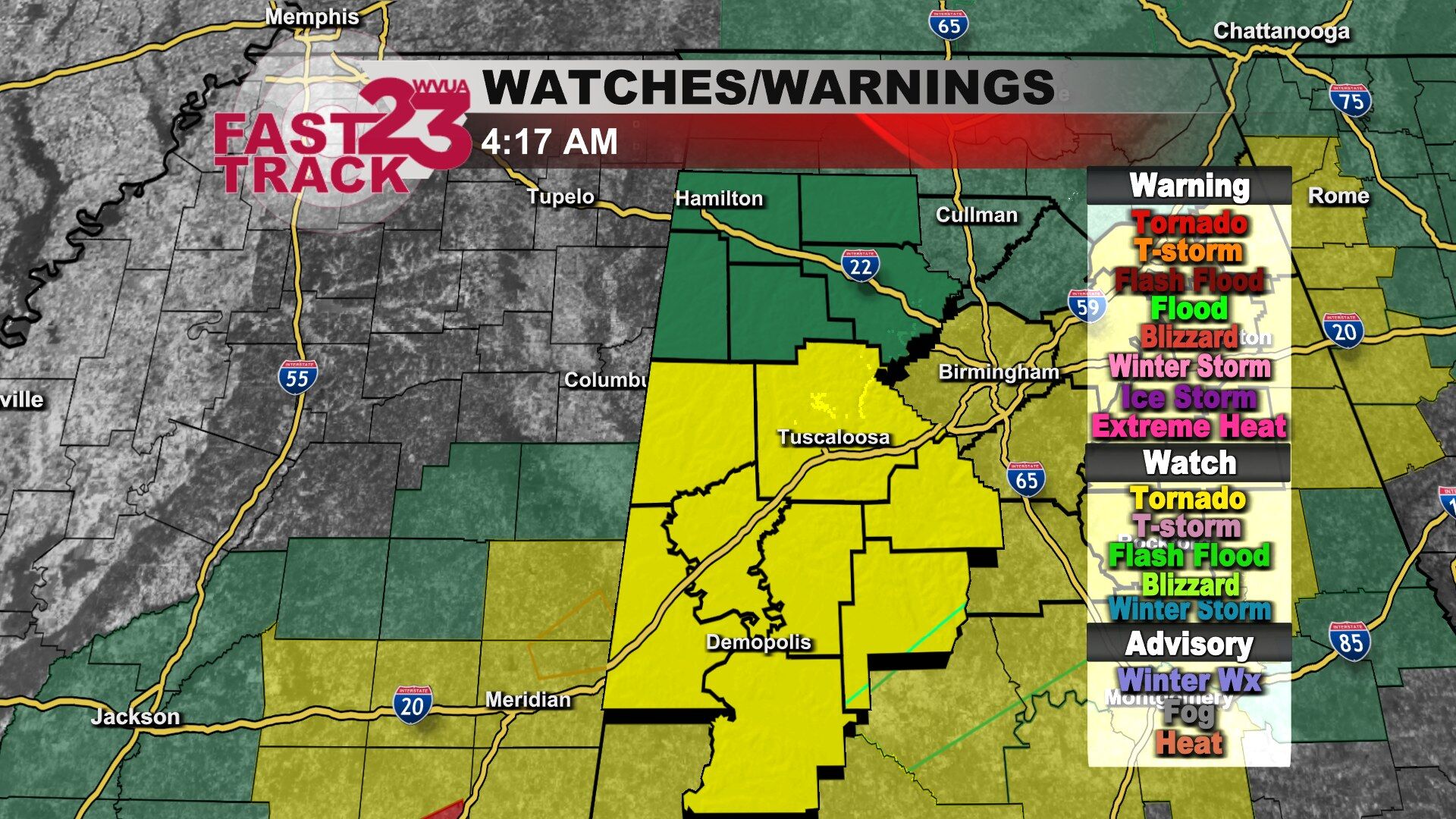
A tornado watch has been issued for several counties in west Alabama, including Pickens, Tuscaloosa, and Marengo, until 10:00 AM today. According to the Chief Meteorologist, the severe weather threat for these counties will diminish by 8:00 AM. While a low-end tornado threat exists, particularly along and south of the HWY 80 corridor, localized flooding is the primary concern. Residents traveling or living in flood-prone areas are urged to exercise caution.
Key Points:
- A tornado watch is in effect for multiple counties in west Alabama until 10:00 AM.
- The most significant threat is localized flooding.
- A low-end tornado risk is present south of Pickens and Tuscaloosa County, especially along the HWY 80 corridor.
- The severe weather threat is expected to subside by 8:00 AM.
- Travelers and residents in flood-prone areas should exercise caution.
Critical Analysis:
The historical context indicates that severe weather events, specifically tornado watches and flood watches, are not uncommon in central Alabama. The events of January 10, 2026, show both a tornado watch issued for central Alabama and a flood watch. This suggests a recurring pattern of severe weather, emphasizing the region’s vulnerability.
Key Takeaways:
- West Alabama faces an immediate threat of tornadoes and flooding.
- Localized flooding poses the most significant risk to residents.
- Severe weather preparedness and caution during travel are crucial.
- Central Alabama is prone to severe weather events, necessitating continuous monitoring and preparedness.
- The timing of the threat, primarily in the early morning, necessitates heightened vigilance during commute hours.
