
Fri Sep 26 18:32:50 UTC 2025: Okay, here’s a summarized news article based on the provided text:
**Headline: NASA-ISRO’s NISAR Satellite Sends First Detailed Images of Earth**
**Bengaluru, India – September 27, 2025:** The NASA-ISRO Synthetic Aperture Radar (NISAR) satellite, a joint Earth-observing mission, has successfully captured and transmitted its first images of Earth’s surface. Launched by ISRO on July 30, 2025, the satellite is nearing full science operations and is already demonstrating its impressive capabilities in providing detailed information for a variety of applications.
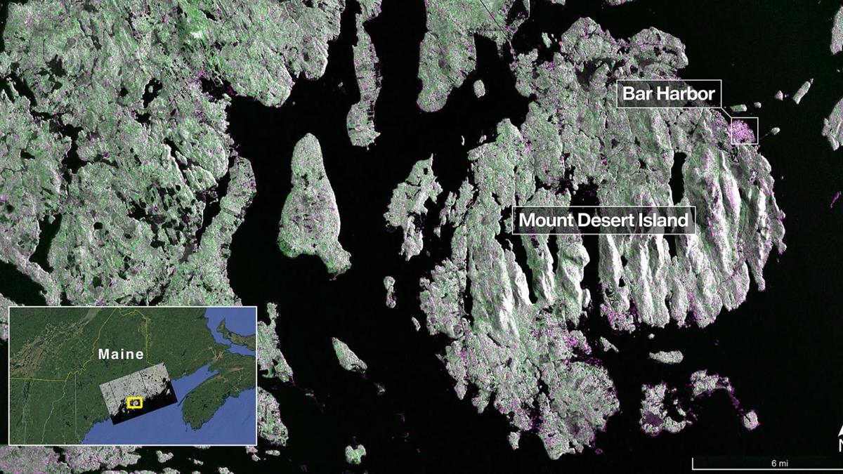
NASA officials highlight that NISAR’s data will be invaluable for disaster response, infrastructure monitoring, and agricultural management. The initial images, captured in August, showcase Mount Desert Island in Maine and a region of northeastern North Dakota. The L-band synthetic aperture radar (SAR) system, provided by NASA’s Jet Propulsion Laboratory, can distinguish between different types of land cover, including forests, wetlands, bare ground, buildings, and even different crops, resolving objects as small as five meters.
“By understanding how our home planet works, we can produce models and analysis of how other planets in our solar system and beyond work as we prepare to send humanity on an epic journey back to the Moon and onward to Mars,” said NASA Associate Administrator Amit Kshatriya.
The success of NISAR highlights the strong collaborative relationship between the U.S. and India in space exploration, demonstrating how international partnerships can achieve significant scientific advancements for the benefit of all. The satellite’s ability to monitor changes in forest and wetland ecosystems, as well as track crop growth throughout the world, will provide critical data for researchers and policymakers alike.
